
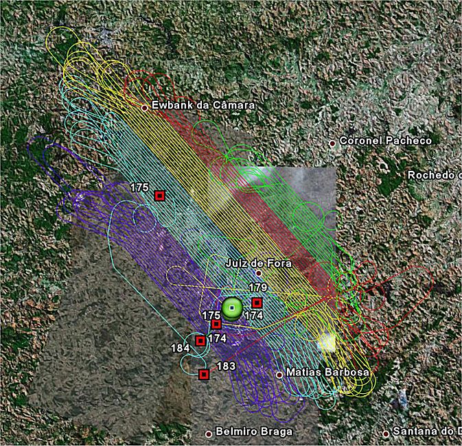
ESTEIO has been using the Precise Point Positioning (PPP) technique, which consists of obtaining precise satellite orbits and clock corrections. In aerial photogrammetry, it is used during trajectory post-processing together with inertial systems, such as in the modern ADS40 digital camera and the ALS 50 LASER scanning sensor.
The technique consists of processing using precise ephemerides, which can be up to 100 times better than broadcast ephemerides. The geodetic reference system adopted for both broadcast and precise ephemerides is the World Geodetic System of 1984 (WGS-84), now coincident with ITRF. Broadcast Ephemerides and Precise Ephemerides are controlled by the DMA – Defense Mapping Agency and distributed by government agencies, such as the IGS, International GNSS Service (formerly International Geodynamics GPS Service), an international service in which institutions from around the world participate as observation stations, data centers and processing centers. Brazil is integrated into the IGS network through RBMC (Brazilian Network for Continuous Monitoring), and station data is forwarded to a global network center located at the Crustal Dynamics Data Information System (CDDIS), operated by NASA. Like the IGS, other agencies distribute GPS and GLONASS data, such as the Jet Propulsion Laboratory (JPL), the Center for Orbit Determination in Europe (CODE), the National Geodetic Survey (NGS), among others.
Post-processing has demonstrated precisions on the order of 15 cm in planimetry and 20 cm in altimetry, provided that the collected data is of high quality and there is minimal loss of GPS signals. There are advantages and disadvantages to using precise ephemerides. The main disadvantage cited is the delay in publishing the most refined data, which can take up to 13 days. The great advantage of this method is the elimination of ground base stations, where simultaneous observations of the same satellites were required between stations (base and rover), thus eliminating differential processing. Another great advantage is the increase in distances between stations, eliminating limits, since in the differential method distances had to be kept within 30 km for LASER scanning and 50 km for the digital camera. Higher flights will bring greater benefits for the exact determination of ambiguities, as often in the differential process there is a difficulty imposed by the troposphere between the altitude of the aircraft and the ground base.
IPAS is the post-processing program developed by Leica Geosystems AG that makes use of PPP (Precise Point Positioning). The main characteristic of IPAS (Inertial Position and Attitude System) is the integration of raw GPS data with raw data from the Inertial IMU system, using precise ephemerides in its new Pro version. The software is oriented toward this application and requires certain precautions to be taken during data collection, such as a minimum tracking period of 60 minutes and a satellite signal cutoff angle of 5 degrees, which allows for faster ambiguity resolution. The program is quite user-friendly, and by identifying the raw aircraft data, it automatically fetches precise ephemeris data from the selected agency.
Types of Ephemerides made available by the IGS:
-
Ultra-rapid: available in real time, orbit precision of 10 cm and 5 ns for satellite clocks;
-
Ultra-rapid (observed half): available three hours after observation, orbit precision <5 cm and 0.2 ns for the satellite clock;
-
Rapid: available seventeen hours after observation, orbit precision <5 cm and 0.1 ns for satellite clocks;
-
Final: available 13 days after observation, orbit precision <5 cm and <0.1 ns for the satellite clock.
Rapid orbits have precision very close to the final orbits, with the difference that the latter has greater precision in the satellite clock, but can be used depending on the precision needs based on the desired mapping scale, with the advantage of being acquired 17 hours after field observations.
IGS products have precisions of a few centimeters and are made available at 15-minute intervals. For satellite orbit interpolation this interval is adequate, but it is not adequate for clock correction, which is why they are also made available at 30-second intervals. Combinations of satellite clock corrections with precise ephemerides provide point positioning using only pseudoranges from a single observation epoch, with precision better than 1 meter. To maintain high-precision point quality, it is essential to work with dual-frequency receivers.
Just as for aerial photogrammetric work, precise ephemerides can also be used for absolute point positioning on the ground. This consists of sending your raw survey data over the Internet to the CSRS (Canadian Spatial Reference System). The center processes precise orbits and satellite clocks, thereby eliminating the need for a second piece of equipment for differential correction. The system works for NAD 83 and ITRF. Data collected over 2 hours allows for precisions on the order of 10 cm, and data collected over 24 hours allows for precisions between 1 and 2 cm. In the kinematic method, the system may be compromised if there is signal loss and there is a need to resolve ambiguities.
Related Articles
- Precise Ephemerides