
Brazilian Cartography is based on European maritime cartography standards, in which the Pole Star determines "North." Before maritime navigation, the reference point was the Sun, and maps pointed east. To this day, we use terms like "to orient oneself" and "disoriented."
On a truly Brazilian map, the reference point would be the Southern Cross rather than the Pole Star, Brazil would surely be at the center, and Europeans would think they were being depicted "upside down."
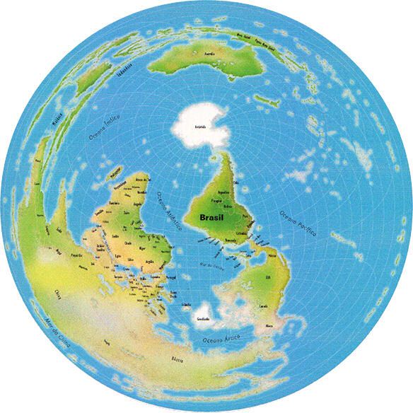
The image shows the first map from a Brazilian perspective, in a projection called equidistant, which measures the distances to all neighboring countries.
We immediately discover, for example, that Porto Alegre is closer to Melbourne, Australia, than to Sudan, Africa; and that New Zealand is closer than California.
If your first impression was that Brazil is upside down, this means your reference point is still European, not Brazilian.